Buffer a Point
Buffer a Point is used to buffer any point on the map, regardless of
whether or not an AUL exists at that point.
Follow the steps below to buffer a
point.
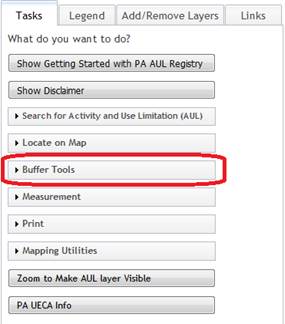
- Select the Tasks tab on the left side of the
screen.
![]()
2.
Click on Buffer Tools to
display menu if necessary.
- Click on Buffer Point, Polyline, or Polygon
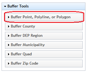
- The Point, Polyline, or Polygon buffer box will be
displayed.

o Click on Point to select a point buffer.
o A distance for the buffer needs to be specified.
As an example, a buffer distance of 1 mile will calculate one mile from
the center of the selected point in multiple directions. This means that the distance from the
northernmost point of the buffer to the southernmost point could actually be
more like two miles (one mile in each direction). The distance is measured according to the unit that is
selected from drop down box. The default is miles. The buffer
distance entered must be greater than 0.
- When finished entering the buffer parameters, click
the "Create Buffer" button.
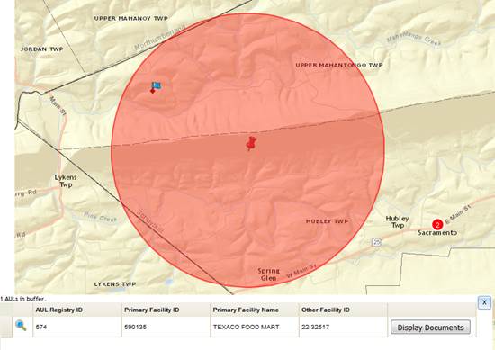
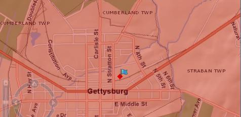
- Click on map to set location to buffer. A
 will
mark the clicked point. The buffer
appears as a red shaded area.
AULs within the buffered zone appear as
will
mark the clicked point. The buffer
appears as a red shaded area.
AULs within the buffered zone appear as  . Buffer
result attributes will be displayed in the bottom left corner of the
application.
. Buffer
result attributes will be displayed in the bottom left corner of the
application.
- Move the buffer grid scroll bar if necessary to the
right to show the Display Documents.
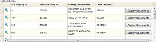
- Click the
 button to display the selected row AUL
documents.
button to display the selected row AUL
documents.
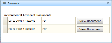
1.
Click the ![]() button to display the selected document.
button to display the selected document.

- Click the
 icon
to zoom the map to the selected row AUL location.
icon
to zoom the map to the selected row AUL location.
- The Clear Selection
tool
 can
be used to clear buffer results.
can
be used to clear buffer results.